MaxiVision
Take production planning to a whole new level
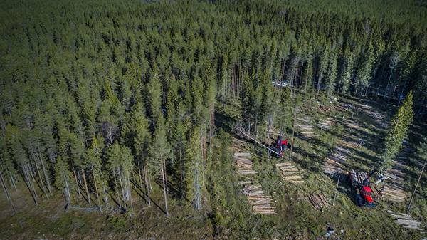
MaxiVision helps you to visualise the state and conditions of the forest, both today and tomorrow. Different map views provide you with data about ground conditions and the rest of the team’s production enabling you to plan your work as efficiently as possible and with minimal forest impact. Since everything is cloudbased, updates occur in real time and any changes are immediately seen onscreen in the cab.
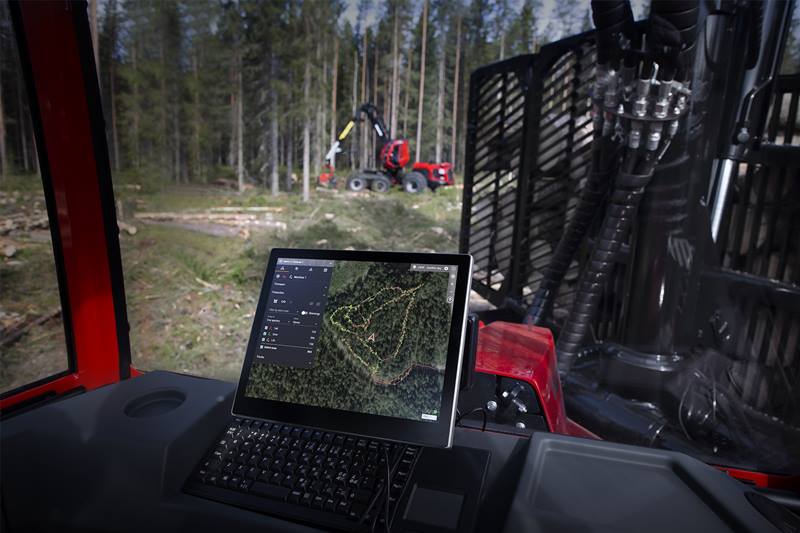
With MaxiVision, you can combine maps of the area with the latest data on ground conditions into a single image and, at the same time, you’ll be able to see both your production data and that of your colleagues – all updated in real time. The work overview is a great tool for planning production and enables you to make well-founded decisions. MaxiVision also allows for effective collaboration between harvesters and forwarders as each team member can see what their colleagues are doing.
In practical terms, this means that the harvester operator can simplify matters for the forwarder operator by – for example, planning suitable access roads, log roads and landings to match the prevailing conditions.In turn, the forwarder operator can see the production in each working zone making it easier to optimise the forwarding process and avoid unnecessary detours. The operator can mark the zone complete once the timber has been forwarded to the landing making follow-ups easier. Once the timber has been forwarded to the landing the operator can mark the zone complete, making follow-ups easier.
The MaxiVision service not only offers team members a good overview of each other’s work, but also helps to facilitate communication between operators. By sending messages to each other or marking particular areas on the map collaboration can be improved and the outcome likewise. This unmatched integration between harvester and forwarder provides an optimised workflow and increased productivity.
The vision of a sustainable future
The map combined with different data layers provides valuable information about current ground conditions in the area where you are working. The knowledge gained from MaxiVision allows for felling and forwarding with less impact on the forest floor, which not only increases the quality of your work, but also helps to meet demands for minimal ground damage. This means long-term sustainability.
The map combined with different data layers provides valuable information about current ground conditions in the area where you are working. The knowledge gained from MaxiVision allows for felling and forwarding with less impact on the forest floor, which not only increases the quality of your work, but also helps to meet demands for minimal ground damage. This means long-term sustainability.